
A geographic information system—or GIS—can help you ride the rising swell of the “data tsunami” by encouraging new and interesting methods of data visualization. Maps can add huge value to health information, by helping to tell important stories and ask important questions.
- You already may be sold on that idea but wonder where to go with it.
- You may have learned the basics of the GIS concept, but you’re now ready to use it.
- You may already be attempting to work with your own geographic data, but have gotten stuck.

If so, these mini tutorials are for you. For the beginning user who needs hands-on experience with the free and full-featured QGIS software, spend about 15 minutes with us in each of these six online modules.
You’ll get the technical knowledge you need to start working with your data. Each module includes videos, graphics, narration, and step-by-step screen shots from within QGIS, with several links to more resources.
Sound useful? Let’s get started.
Click on one of the tabs to the right for more information, including a user guide. Or just dive right in to our interactive mini-tutorials by clicking on one of the pictures below to instantly launch a responsive video in a new tab.
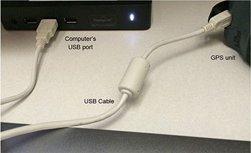

Take a hand-held GPS receiver unit containing coordinate (x, y) data, plug it into your computer, and use it QGIS.
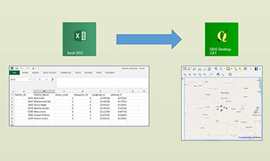
Format an Excel spreadsheet containing coordinate (x, y) data, import the data to QGIS and plot the locations.
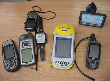

Walk through through the process of collecting x, y coordinates (waypoints) with a hand-held GPS receiver unit.


Practice working with project files and properly referencing a shapefile. Practice fixing broken links and creating a shareable map package.
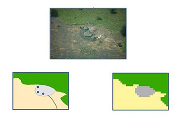
Practice choosing a projection that works with your data, and practice properly aligning data layers.

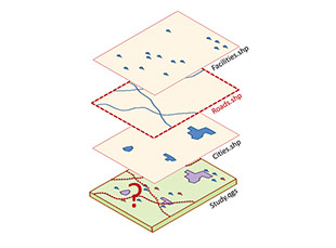
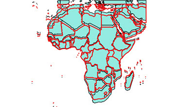
Learn the differences between raster and vector files, and practice working with and zipping “shapefiles”, the most common type of geographic data file.